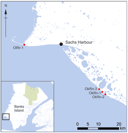
2013 survey of archaeological sites
|
In 2013, we wanted to learn more about the Thule-Inuit sites close to Sachs Harbour without disturbing them, so we used special equipment to map the sites and “look” beneath the ground. In July we mapped the archaeological features on four Thule-Inuit archaeological sites on the southwest coast of Banks Island, occupied in the period between roughly 1200 and 1600 AD. Each has the remains of multiple large houses made of sod and whale bone. We collected animal bones for radiocarbon dating and conducted geophysical survey. The geophysical survey was most effective at Agvik (OkRn-1).
How do archaeologists “see” beneath the ground? Archaeologists use geophysical instruments to “look” under the soil. These instruments measure tiny differences in the properties of the soil in areas where people once lived. We used two different instruments that measure differences in the magnetic properties of soils, a magnetometer and a magnetic susceptibility meter. People can influence soil magnetism in lots of ways through every day activities: |
- Heating and burning, for example by making cooking fires, increases soil magnetism.
- Butchering animals, processing hides, and preparing meals creates waste where bacteria grow. These bacteria increase soil magnetism.
- Digging holes and removing sod moves topsoil around. This affects magnetism because topsoil is more magnetic than the soil underneath. Removing topsoil decreases magnetism while piling it up increases magnetism.
To use a magnetometer or magnetic susceptibility meter, archaeologists first set up a grid over an archaeological site. Then they walk of the lines of the grid with the instrument, which records the magnetic properties of the soil. Check out the Time Team videos below to see a magnetometer in action!
|
|
|
What can geophysical survey tell archaeologists?
Geophysical surveys can help archaeologists understand structures on the surface of a site and even identify new structures that are not visible on the surface. The IAP team also found that magnetometer survey can help identify frost wedges. This is important because when temperatures rise and permafrost thaws, frost wedges form weak points where large chunks of earth can break off along the coast. These surveys can help us see which archaeological features are most at risk of being destroyed by the effects of climate change.
Some questions, like What were people doing inside the house? and What artifacts are under the surface? can only be answered through excavation, but the survey techniques we used during the 2013 field season can give a good sense of the number and nature of structures on a site, without any digging.
Click here to see what we learned about each site!


