
Survey of Cape KelletT
Cape Kellett (OlRr-1) is a Thule-Inuit archaeological site on southwest coast of Banks Island. The site contains nine Thule-Inuit houses, three of which were partially excavated by T.H. Manning in 1952 during his Defence Research Board expedition. Only very sparse records remain from his research. In addition to the houses there are also the remains of a wooden shack used by Manning to store equipment and a recent tent ring. The site was occupied during at least two different times, first around 1200 AD and again around 1350 AD.
During our fieldwork in 2013, we mapped nine houses at the site and labeled them Houses 1 through 9 from west to east (Figure 1). Little remains of Houses 1 and 2, which have eroded away to expose the beach gravel. The bases of several whale bone posts and small circles of vegetation are all that remain of these houses. Houses 3, 4 and 5 are more intact, but all display evidence of disturbance as a result of digging and/or erosion.
The magnetometer survey shows several natural permafrost features and disturbance from Manning’s investigations (Figure 2). The many small black circles on the figure are likely produced by rocks (glacial erratics) containing natural iron. The white areas with small black circles in the northeast are produced by iron nails from Manning’s shack (Figure 2), the remains of which are still visible on the ground surface. Another smaller cluster within House 6 probably represents nails or grid pegs left in one of Manning’s excavation trenches. The magnetometer also picked up the structure of the dwellings. House 5 is a very good example (Figure 3).
Two magnetic susceptibility surveys were conducted at Cape Kellett, one broad-scale survey at 5 m intervals and a second smaller, close-interval survey at 1 m intervals. Neither picked up obvious signals from the houses, but they did identify magnetic features that may be linked to Manning’s activity at the site (Figure 4). Increasing the frequency of the readings might lead to better results.
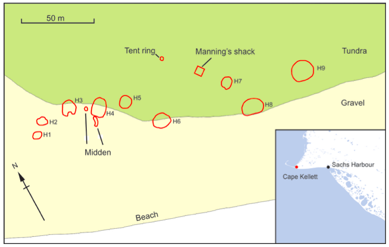
Figure 1: Distribution of Archaeological Features at Cape Kellett (OlRr-1).
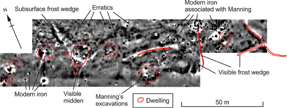
Figure 2: Annotated magnetometer results at Cape Kellett (OlRr-1).
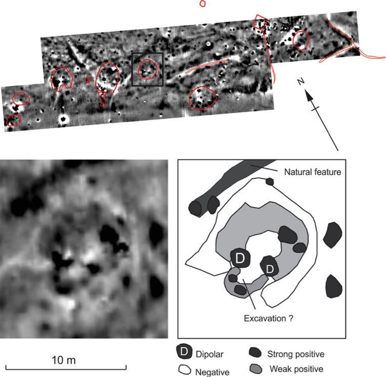
Figure 3: Annotated detail of magnetometer results from House 5 at Cape Kellett (OlRr-1).
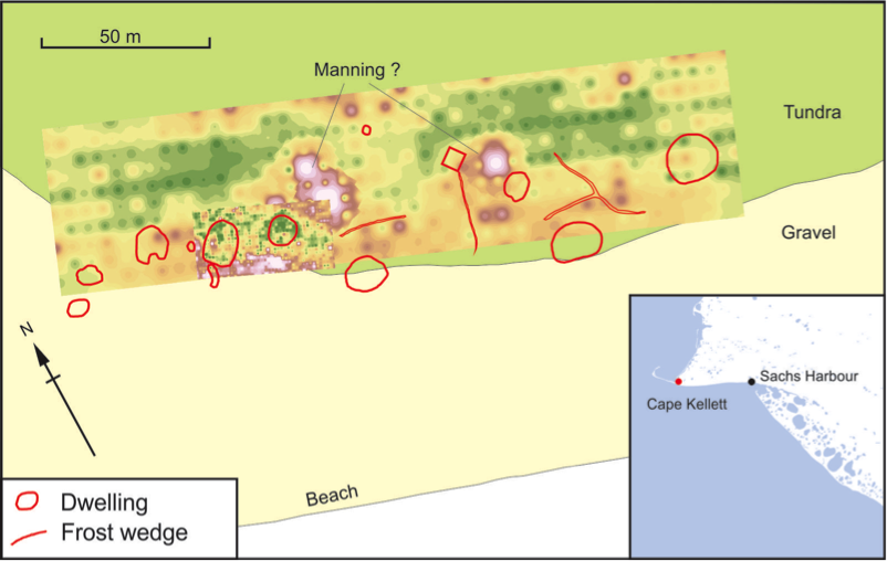
Figure 4: Map showing main archaeological features and magnetic susceptibility results at Cape Kellett (OlRr-1).
