Survey Of OkRn-2
|
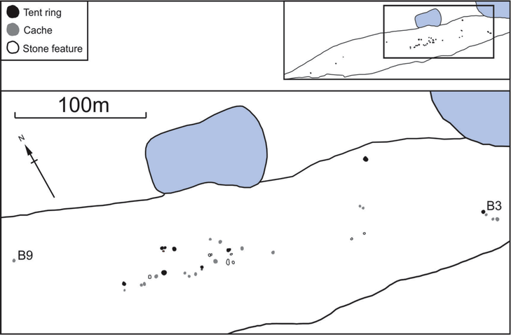
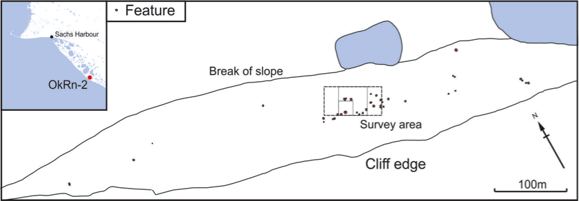
OkRn-2 consists of numerous stone features spread along a gravel ridge. More caches are found along a second ridge immediately northwest of the first (Figures 1). We noted 18 caches in the main part of the site, as well as 9 tent rings and 10 additional stone features of unknown function. Some may have been used for drying skins or meat. Four more caches, the easternmost of which contains a complete polar bear skull, were noted on the second ridge. Only two artifacts were observed at the site. Both were photographed and left in place. One is worked antler, the second is a piece of worked bone or antler with 2 drilled holes. Both are quite badly weathered.
Two new radiocarbon dates from the site indicate that it was used around 1400 AD during Thule Inuit times. These dates overlap with the earlier set of dates from nearby OkRn-1. OkRn-2 could well have been used in the warmer months by people who wintered at OkRn-1. Of course, these dates do not rule out the use of OkRn-2 over a longer period, and more dates would help to clarify whether the site was used fairly briefly, or reused many times. |
|
Geophysical Survey Results
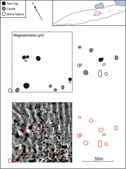
The magnetometer survey at OkRn-2 was not able to pick up any archaeological features (Figures 2 and 3). The white lines that run from the top to the bottom of Figure 31 line up with shallow drainage channels that run down the slope of the ridge towards the pond. The small black circles in the survey data do not line up with any of the archaeological features and are probably caused by rocks or frost action.
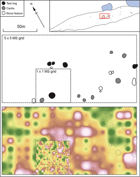
The magnetic susceptibility survey was also unsuccessful (Figure 4). Magnetic survey techniques often identify archaeological features created when people move soil around. There is no soil at OkRn-2, just exposed gravel, so it is not surprising that these techniques did not work well here.


